Barrett Lane and the Thatched Cottages
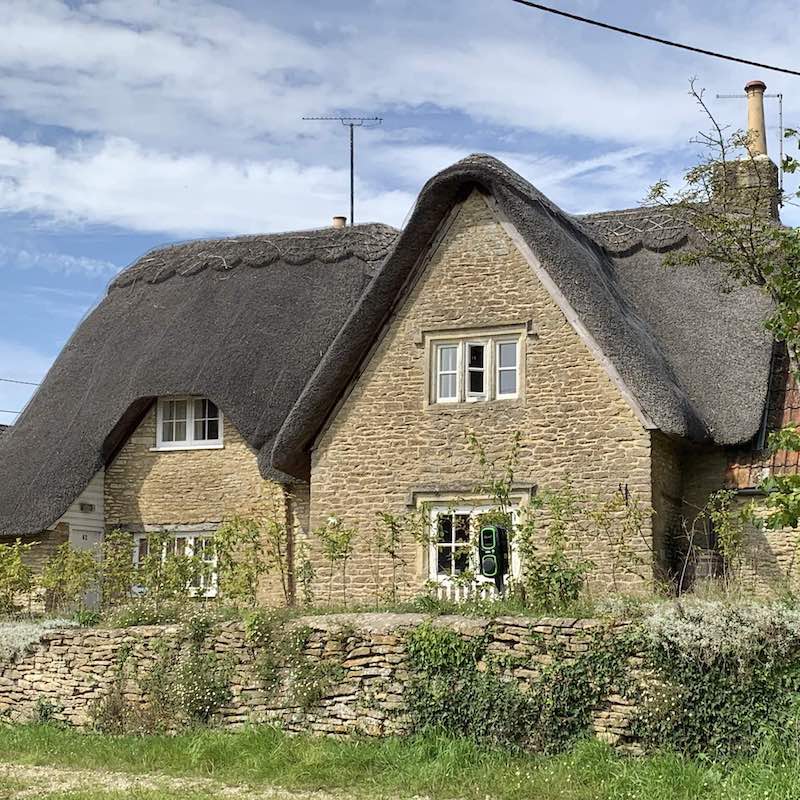
The majority of houses in Sutton Benger looked like No 62 High Street at one time. The 1920 Auction catalogue tells us that just 100 years ago there were many more thatched houses in the village than today. Barrett Lane and the houses in this area have several stories to tell.
The sepia photograph / postcard of 'Thatched Cottages, Sutton Benger' was taken from the end of Sutton Lane, next to Forge Cottage, looking north towards the cottages on the other side of the High Street. The cottage that can be seen is No 62 High Street.
Barrett Lane
Barrett Lane today is just the short lane which goes north from the High Street. But in the 1800s and earlier it was a more important route, with a dog leg turning right towards the River Avon, known on one record as 'The Drove to Barratts'. This east-west part of Barrett Lane is actually still there today, but only as a footpath which leads to the main road at the bridge over the River Avon, as you reach Christian Malford.
The 1808 and 1839 surveys tell us that the fields east of the village, to the north and south of Barrett Lane, were known as 'the Barretts (or Barratts)'; some of them had the names of the tenants who had leased them. Barrett Lane was 'the Drove' or lane leading to 'Barrett' field and 'Great Barrett' field and 'Messiter's Barrett' and 'Ferris's Barrett' and so on.
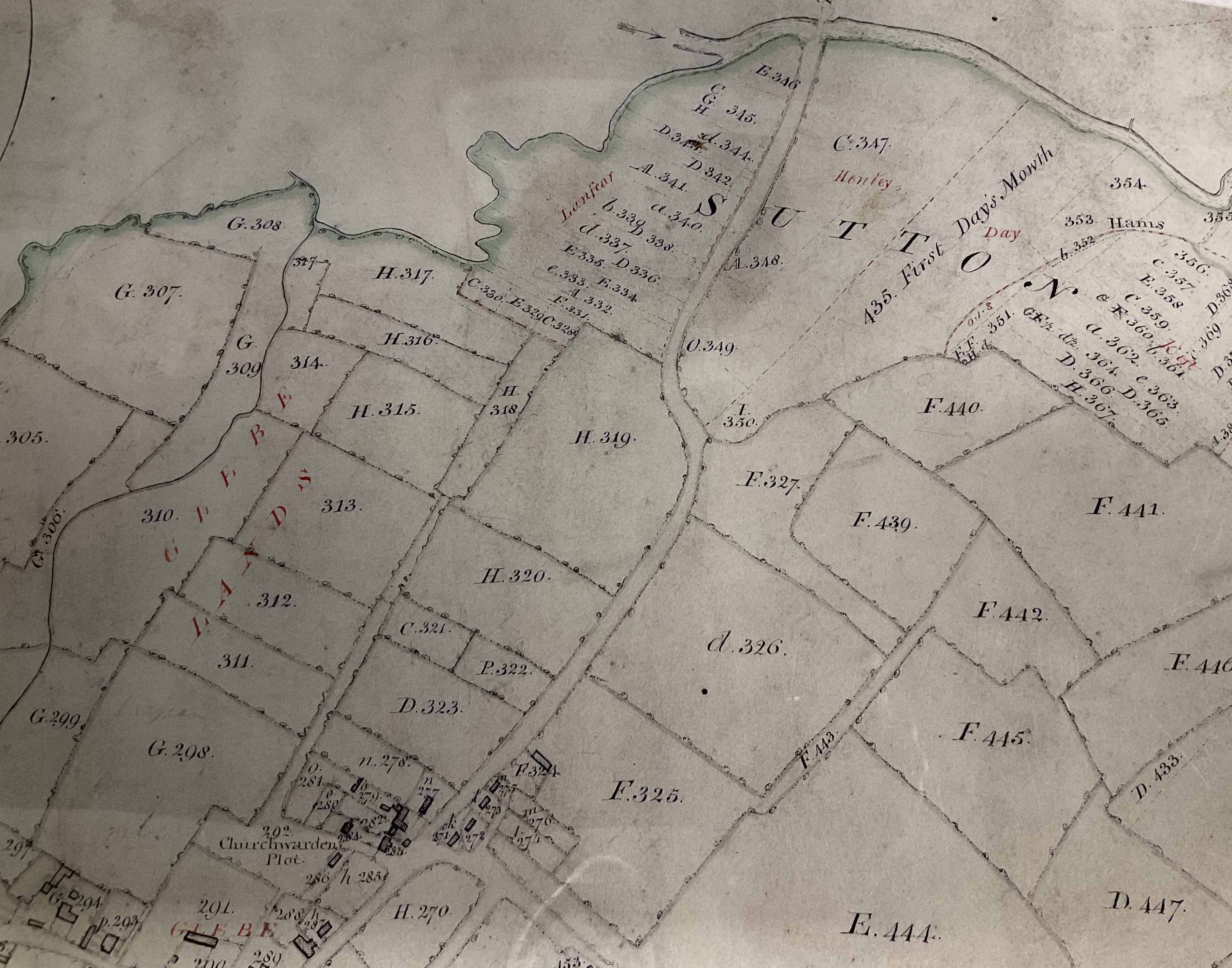
The 1808 map had east, and the River Avon, at the top. #280 is the church; #293 is the house that became La Flambé; #283 is the house that is now 62 High Street.
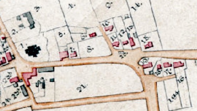
This next map is the 1839 map, which has east at the right. The identifying numbers use a different system, but the layout of the village has hardly changed, with roughly the same houses in the same locations.
60-64 High Street; the 'Russ Copyhold'
A large bundle of documents in the Archives at the Wiltshire and Swindon History Centre relate to the inheritance of land and buildings in this part of Sutton Benger; for simplicity, these are known collectively as 'The Russ Copyhold'. A legal discussion, which began in 1848 and did not end until 1861, established the rights of claimants to the plots of land identified as #9, #10, and #11 on the 1839 map - the location of today's 60-64 High Street.
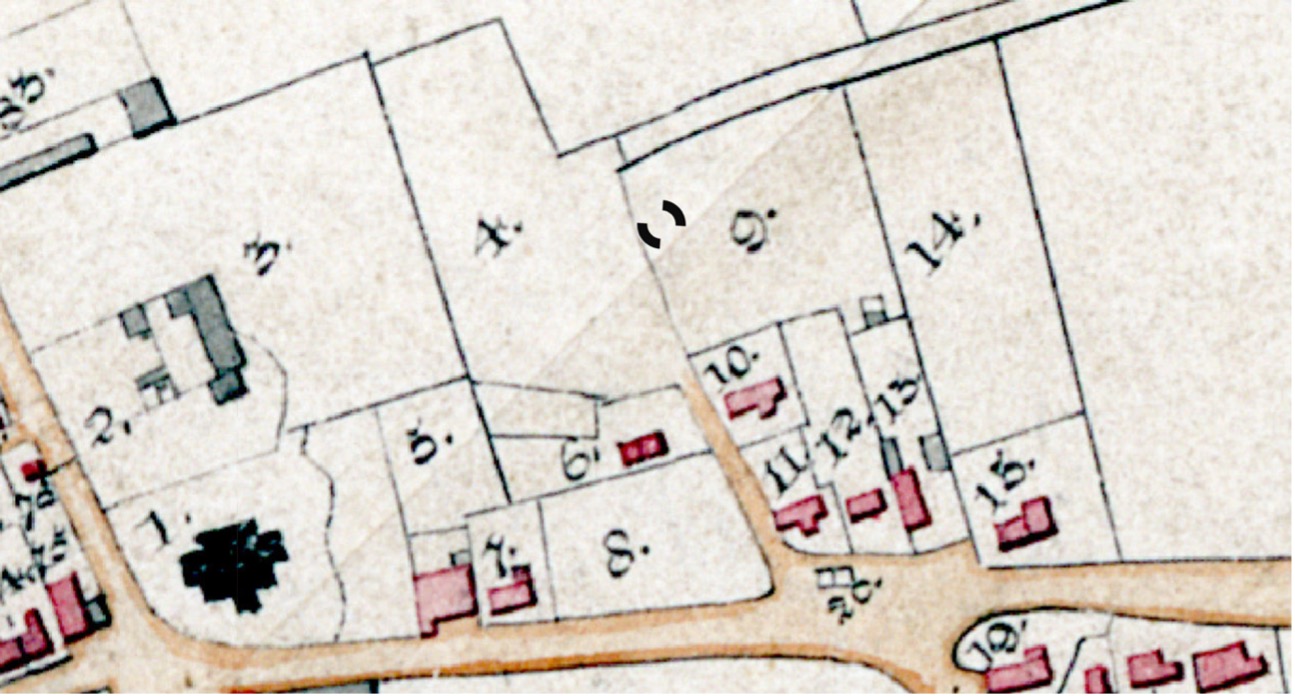
The documents begin with a 1744 lease, and show that the Russ family had the rights to two houses throughout the 1800s, one each on plots #10 and #11; the two buildings were each divided into two cottages. The building at #11 is the one still standing today, known as 62 / 64 High Street.
The solicitors established that the properties were held in law by Daniel Russ, who had moved to Hampshire. He voluntarily gave up his rights, and the land reverted to the Lord of the Manor.
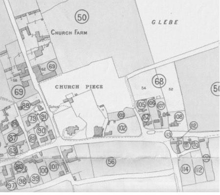
It was sold in the 1920 Auction as Lot 104.
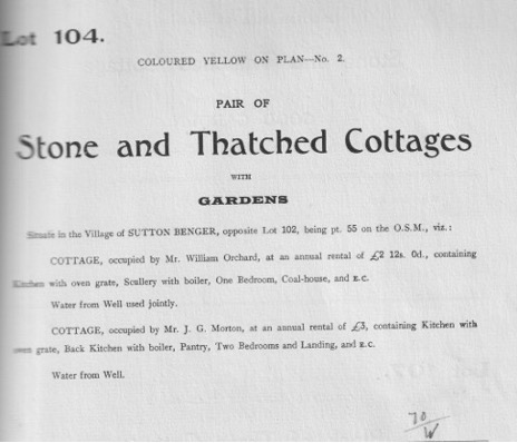
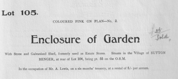
The building to the north, at #10, had become derelict some time before the 1920 Auction, when it was advertised as Lot 105: a 'stone and galvanised shed'. The modern bungalow, 60a High Street, stands there today.
Grade II Listing
62 / 64 High Street is a Grade II Listed Building, described as follows:
Listed Entry Number: 1022405 Listing NGR: ST9486478730
House, now two cottages, C17, rubble stone with thatched roof, half-hipped to west and east end stack. 1½ storeys. Large right projecting gable with first floor 3-light ovolo-moulded mullion window and hoodmould over casement pair in similar surround with hoodmould. Door to No 64 in west side of gable. Small square window to left, then straight joint. No 62, to left, has eyebrow over upper casement pair and ground floor triple casement and roof carried down to left over porch with door on west side.
66 High Street
No 66 High Street is at #12 on the 1839 map.
It is a Grade II Listed Building.
Listed Entry Number: 1300685 Listing NGR: ST9488478735
House, C17, painted rubble stone with thatched half-hipped roof and rebuilt west stack. l½ storeys with two eyebrow dormers and small square light in thatch over centre door. Left eyebrow is over C20 upper window and ground floor casement pair, probably C20 with some brick above and each side. Right eyebrow is over slightly advanced wall with upper casement pair and lower triple casement.
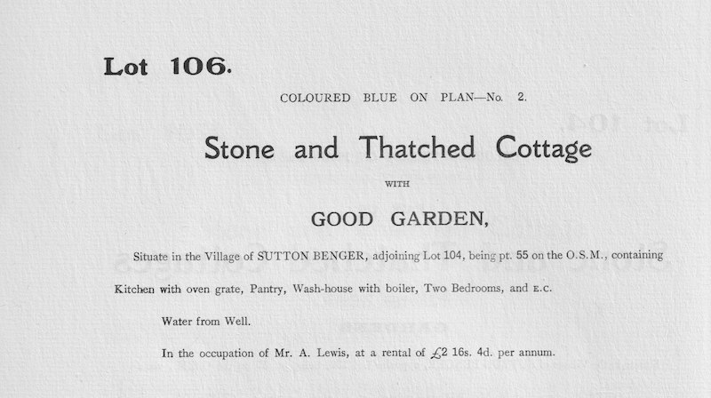
It was in the 1920 Auction as Lot 106.
68-72 High Street; the 'Hayward Copyhold'
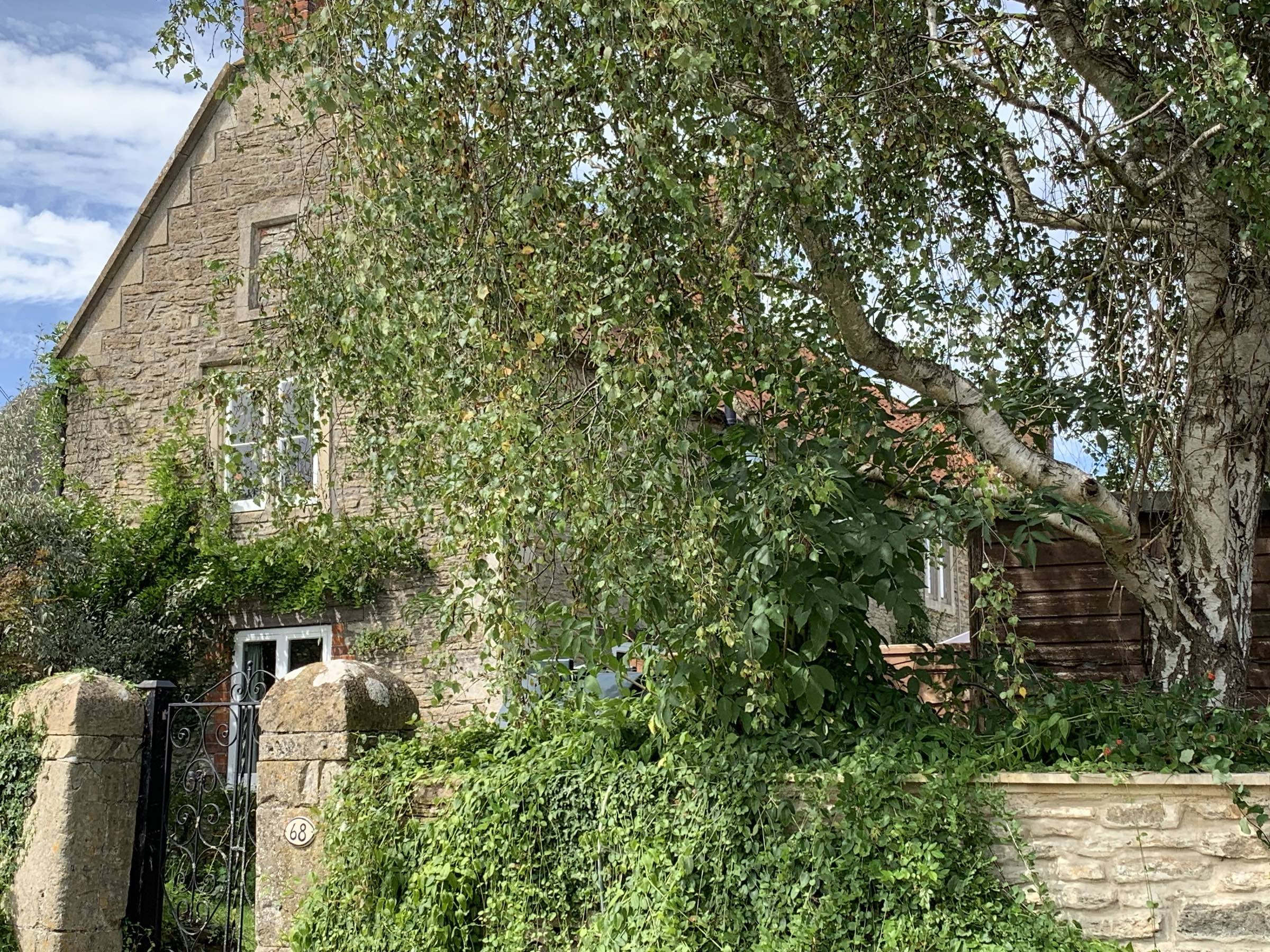
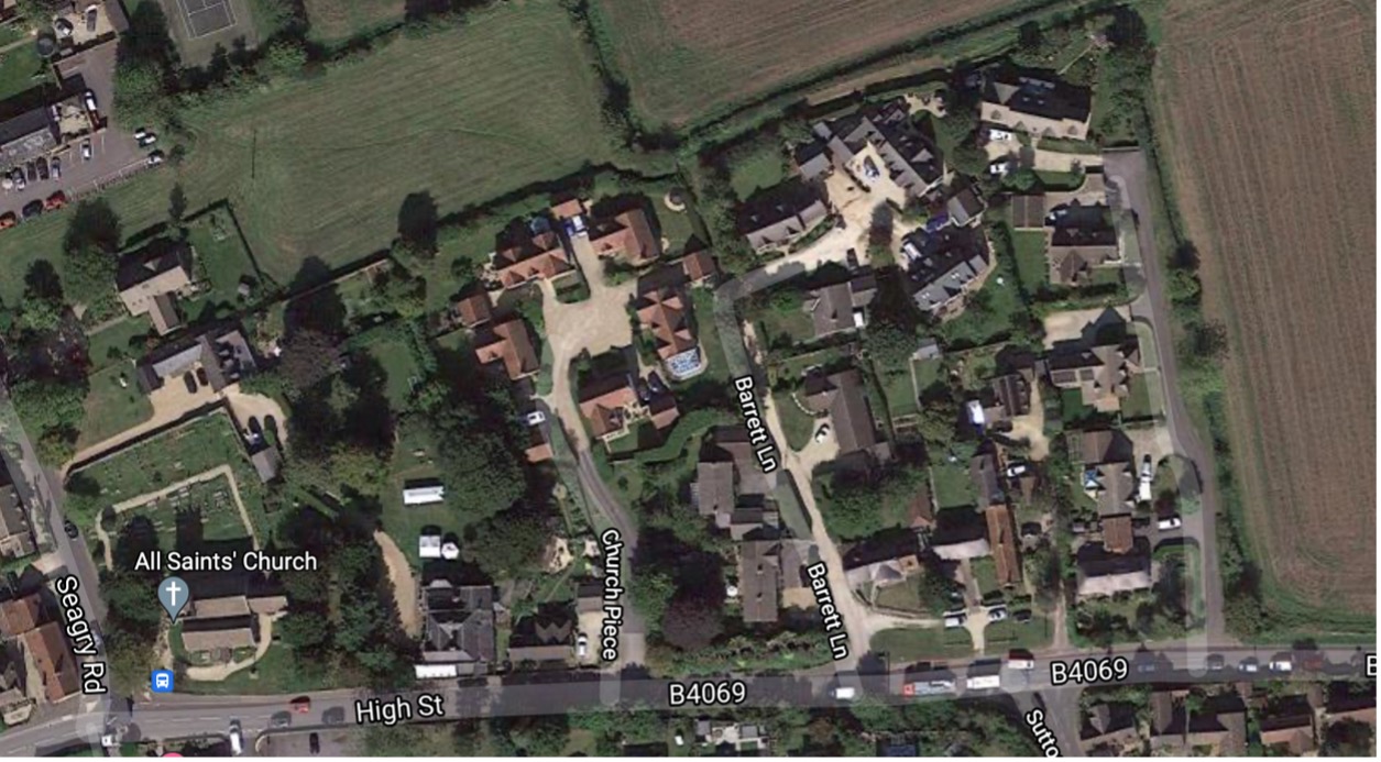
A large group of deeds and other papers in the Archives relate to the ‘Hayward Copyhold’ – land and buildings south east of Church Piece and Barrett Lane, where a family of butchers called Hayward ran their business from between about 1800 and about 1850.

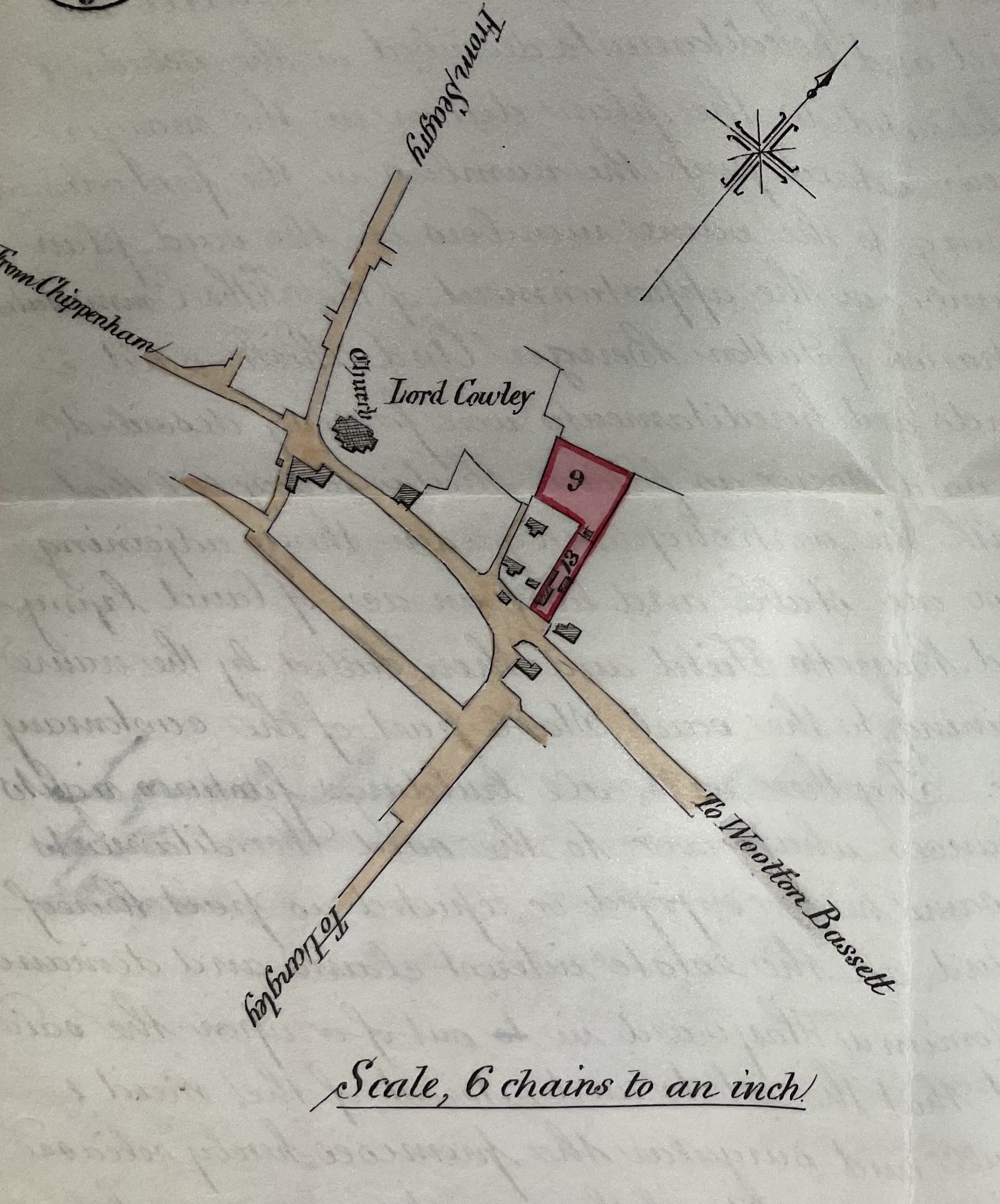
The land was plots #9 and #13 on the 1839 map: #9 today is the location of modern houses built at the north eastern end of Barrett Lane, ‘Paddock End’ and ‘Avonstone House’ and Bloomfield House. #13 is the location of the older properties 68 / 72 High Street, as well as the newer property 72a.
The rights to the land and property in around 1800 were held by Thomas Hayward, described as a 'Pig Killer', aged 54 in 1828. The documents refer to his cottage, workshops, stable, etc, and ½ acre of land 'formerly called Barrett’s Field, now Rack Close'. A 'rack close' was where cloth makers hung out the cloth to dry in the sun; one of the tenants here in the late 1700s was William Fry. He was the brother of John Fry, who had built the house that is now La Flambé.
A summary from 1872 described the property as follows:
This property consists of a dwelling house containing two (? sitting) rooms, kitchen and cellar on ground floor and four bedrooms over, pig killing and bacon curing shops with two rooms over adjacent dwelling house, brewhouse and cart shed, rear stable and cart shed in the orchard with garden and orchard, altogether containing 1a 0r 3p. The inside and roof of house require repair, the brewhouse and cart shed and the old stable and cart shed are in very bad repair.
Part of the buildings were put up specially for bacon curing, but the premises are not likely to let again for that purpose and they are not in their present state adapted for any other business.
Taking into account the difficulty it is to compel the repair of copyhold property I consider it desirable for the Trustees to purchase Mrs Hayward’s interest and taking into account the value of the dilapidations I would advise £55 to be given for it.
I could not ascertain the reserved rent paid to the Trustees – if it be of any material amount nine years rent should be deducted from the £55.
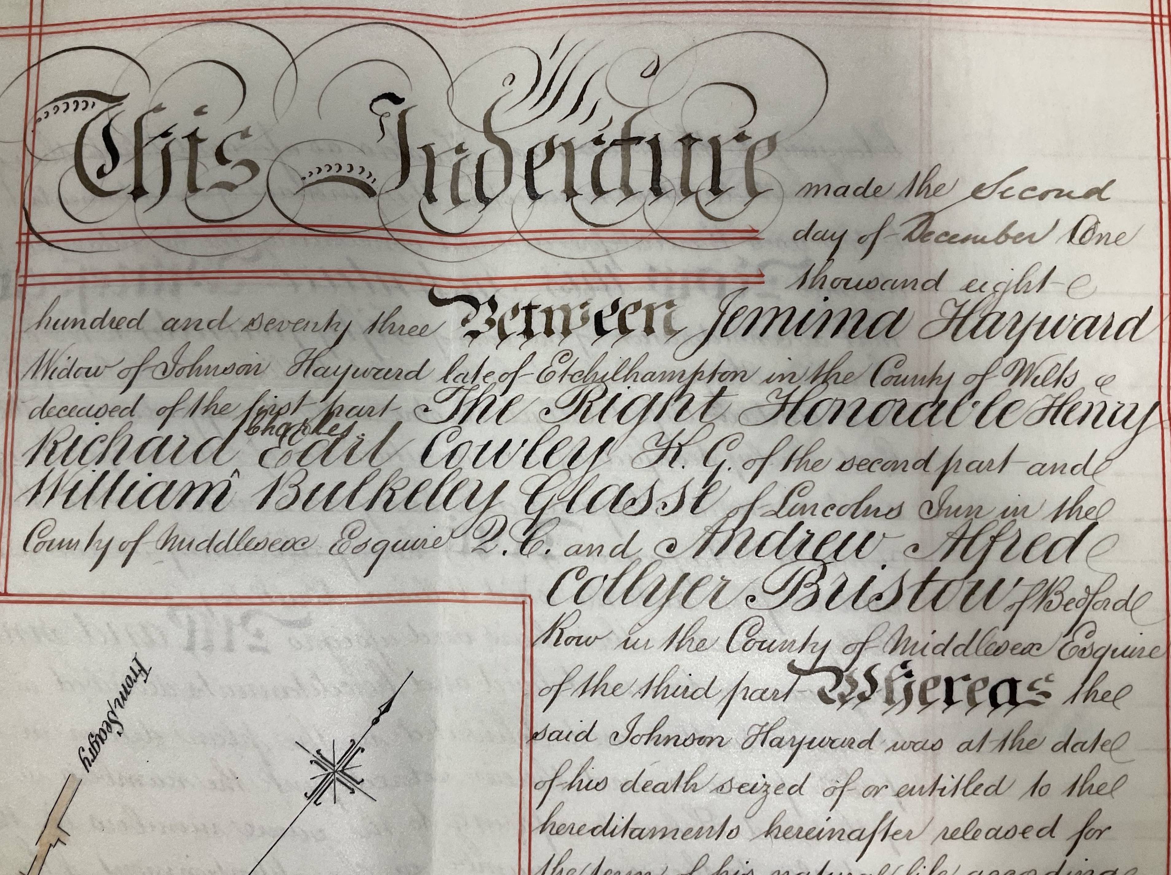
An Indenture of 1873, with a detailed plan of the area, identified Jemima Hayward, widow of Johnson Hayward, as the legal tenant. She gave up her rights and Lord Cowley took it back.
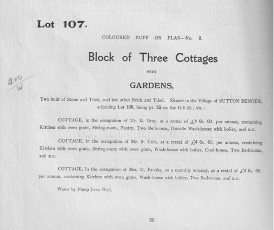
68-72 High Street were sold in 1920 as Lot 107. One of the tenants at the time was Robert Bray, formerly the blacksmith at Forge Cottage.
Grade II Listing
It is today a Grade II Listed Building.
Listed Entry Number: 1363825 Listing NGR: ST9489278733
Pair of houses, C18, roughcast rubble stone with pantiled roof, coped south gable with end stack, ridge stack and north end stack, on front roof slope Two storeys, gabled-ended to road. No 6 has end-wall first floor 2-light mullion window and hoodmould and east front first floor casement and 2-light cyma-moulded flush mullion window, ground floor casements each side of fielded 4-panel door with hood on brackets. Ground floor right window has hoodmould. No 70, to right, has first floor unmoulded 2-light window on brackets. North end wall has 2-light cyma-moulded flush mullion window and hoodmould. Included for group value.
74-76 High Street
74-76 High Street is at #15 on the 1839 map.
It is a Grade II Listed Building.
Listed Entry Number: 1200570 Listing NGR: ST9491278730
Pair of cottages, now one house, rubble stone with thatched roof, hipped to west, half-hipped to east, and ridge stack. 1½ storeys, two eyebrows over casement pairs with thatch carried down over door between. Casement pair to left of door, triple casement to right, then door and casement pair to right. Left end, under roof hip is apparently added, with front C20 casement. Included for group value.
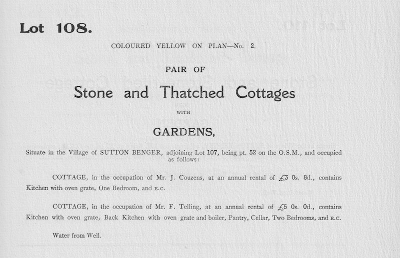
It was in the 1920 Auction as Lot 108.
Residential
Discover more places in the places index.
Places Index